GeoKolam research data
GIS and on-device remote sensing tests of GeoKolam
Data and analysis scripts for a study of GeoKolam, the free Android GIS from ArcGX TechLabs Private Limited. The study tests the app's measurement, file formats and vector tools on the 38 district boundaries of Tamil Nadu from TNGIS, and its on-device satellite maps over Tiruchirappalli district against a 10 m reference made with GDAL.
Key results
All numbers come from logged runs. The logs are in the results and scripts download.
Maps made by the app
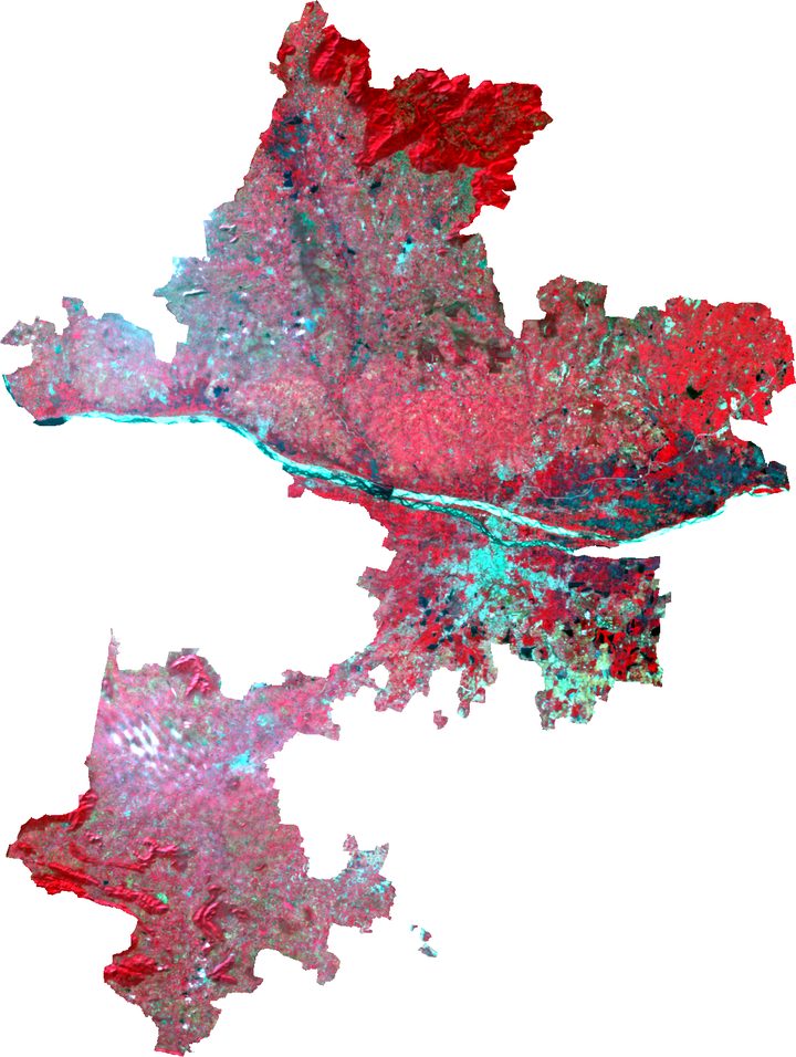
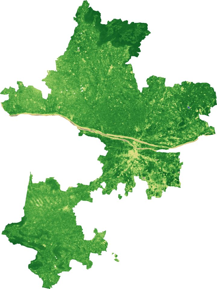
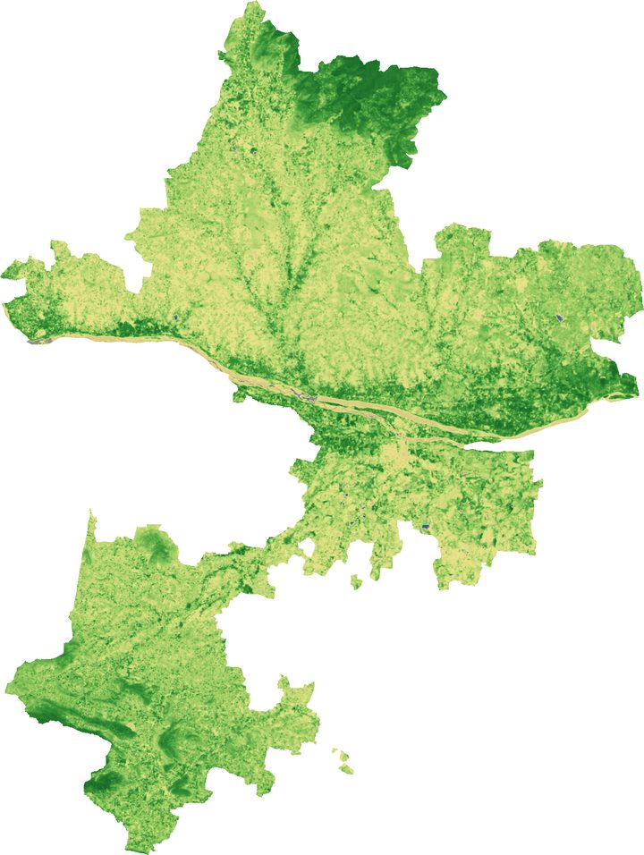
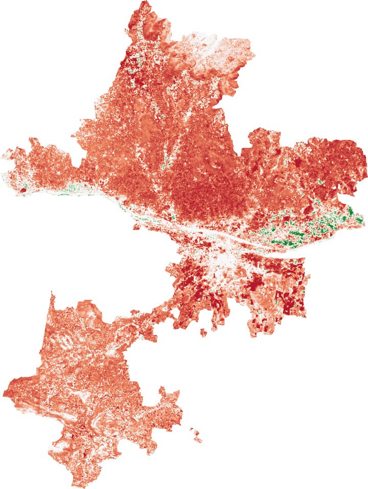
Tiruchirappalli district from Sentinel-2B passes on 13 December 2025 and 3 March 2026, at 80 m cells, as the app rendered them. NDVI fell from 0.60 to 0.39, mostly on cropland after the Samba rice harvest.
Downloads
Each download is a zip file with a short readme inside.
Result logs for every run, the 10 m reference results, the summary tables and the Python scripts for the reference, the checks and the figures.
Eight GeoTIFFs made by the app at 80 m in UTM zone 44N: NDVI and NDWI for both dates, NDVI change, false colour for both dates and true colour for December.
Elevation and slope at 60 m from the Copernicus DEM and land cover at 80 m from ESA WorldCover 2021, made by the app.
The 38 TNGIS district boundaries written by the app's own exporters, with English names, Tamil names and LGD codes.
The same boundaries as GPX tracks of the outer rings and as DXF polylines in UTM zone 44N.
GeoJSON outputs of the app's vector tools run without GEOS: centroids, convex hulls, simplification, fishnet, clipping, random points and point counts.
Data sources
- District boundaries: Tamil Nadu Geographical Information System (TNGIS), Tamil Nadu e-Governance Agency, published for public use.
- Sentinel-2 Level-2A: Cloud Optimized GeoTIFFs on the Registry of Open Data on AWS. Contains modified Copernicus Sentinel data 2025 and 2026.
- Elevation: Copernicus DEM GLO-30, doi.org/10.5069/G9028PQB.
- Land cover: ESA WorldCover 2021 v200, doi.org/10.5281/zenodo.7254221, CC BY 4.0.
GeoKolam's source code is proprietary to ArcGX TechLabs Private Limited and is not published. The test programs that run the app's own code depend on it, so they are not published either. Their results are in the logs above.
How to cite
Suneel Bose K. (2026). GeoKolam research data: GIS and on-device remote sensing tests in Tamil Nadu and Tiruchirappalli district [Data set]. ArcGX TechLabs Private Limited. https://www.bosekarmegam.in/research/geokolam/